Skip navigation

Top navigation skipped.

 A REVIEW OF THE TEXAS ECONOMY
February 2025 | By Spencer Grubbs
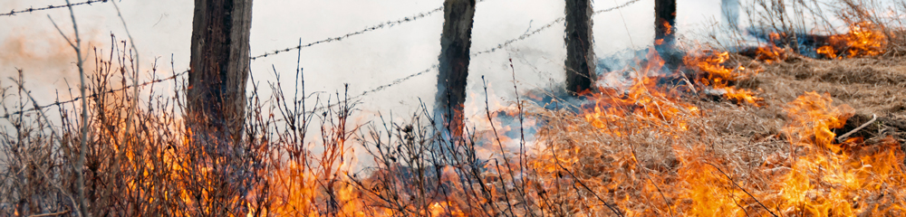
Texas communities face elevated wildfire threats
The recent wildfires in the Los Angeles area — by one estimate, destroying more than 16,000 structures and killing 27, as of Jan. 22 — have shocked the nation, largely due to their proximity to the country’s second-most populous city. But experts say that other large metros in states prone to wildfires — including Texas — should be on high alert.
85% of Texas wildfires start within two miles of a community.
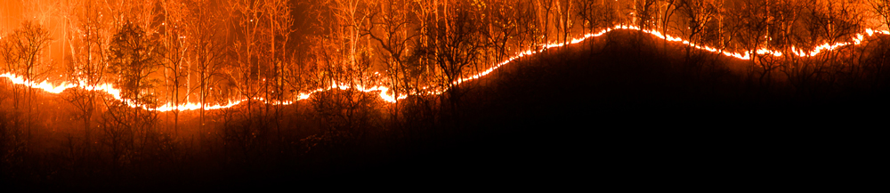
These two miles are commonly called the wildland-urban interface (WUI) zone: the area where manmade structures meet undeveloped land with easy-to-ignite vegetation when conditions are right. As population grows, so does the WUI.
In Texas, 3.2 million housing units are in the WUI, second only to California nationally.
Since 2005, more than 243,000 separate Texas wildfires have burned 13.9 million total acres. In 2024, the Smokehouse Creek Fire burned more than 1 million acres in the Panhandle, making it the largest wildfire in the state’s history.
Bastrop County Complex Fire burned around 32,000 acres and destroyed more than 1,600 homes (PDF). The Riley Road Fire, which started at roughly the same time as the Bastrop fires but closer to Houston, lasted for 28 days and burned nearly 20,000 acres across three counties.
According to property analytics company Cotality, Austin and San Antonio are at a high risk of experiencing wildfires. The U.S. Department of Agriculture's Forest Service summarizes the wildfire risk to these cities, among others, in its interactive online resource Wildfire Risk to Communities. Risk factors include slope, fuel, surface composition, drought and wind.
AUSTIN WILDFIRE RISK SNAPSHOT
Wildfire risk is
higher than 74% of
communities in
the U.S.
Risk to homes
HIGH
The susceptibility of homes to damage from wildfire, in places with existing homes and places where new construction is proposed.
Wildfire likelihood
HIGH
Probability of a wildfire in any given year.
Risk reduction zones*
HIGH
- 60% of buildings are in minimal exposure zone.
- 23% of buildings are in indirect exposure zone.
- 18% of buildings are in direct exposure zone.
SAN ANTONIO WILDFIRE RISK SNAPSHOT
Wildfire risk is
higher than 70% of
communities in
the U.S.
Risk to homes
MEDIUM
The susceptibility of homes to damage from wildfire, in places with existing homes and places where new construction is proposed.
Wildfire likelihood
MEDIUM
Probability of a wildfire in any given year.
Risk reduction zones*
MEDIUM
- 79% of buildings are in minimal exposure zone.
- 11% of buildings are in indirect exposure zone.
- 10% of buildings are in direct exposure zone.
* Types of risk reduction zones:
Minimal: Homes are not likely to be subjected to wildfire.
Indirect: Homes may be ignited by sources such as embers and home-to-home ignition.
Direct: Homes may be ignited by adjacent flammable vegetation, as well as indirect sources.
In 2024, an estimated 244,617 Texas homes were at significant risk of wildfires.
Total reconstruction costs were valued at more than $88 billion.
The state's capital is ranked fifth in the nation for cities with the greatest number of homes at risk of wildfires, following four cities in California.
Number of homes at moderate or greater risk and their respective reconstruction costs, 2024:
Roll over bars in charts to see reconstruction costs.
By State
By Metro Area
Note: Totals may not sum due to rounding.
Data for State and Metro Areas
| State | Number of homes | Cost (in billions) |
|---|---|---|
| California | 1,258,748 | $769.4 |
| Colorado | 321,294 | $140.9 |
| Texas | 244,617 | $88.4 |
| Oregon | 129,567 | $45.3 |
| Arizona | 124,603 | $36.2 |
| New Mexico | 120,093 | $34.7 |
| Idaho | 104,782 | $34.9 |
| Montana | 88,102 | $31.3 |
| Utah | 67,023 | $32.3 |
| Washington | 59,563 | $20.9 |
| Metro area | Number of homes | Cost (billions) |
|---|---|---|
| Los Angeles, CA | 245,670 | $186.6 |
| Riverside, CA | 210,859 | $112.8 |
| San Diego, CA | 138,600 | $87.9 |
| Sacramento, CA | 100,814 | $61.1 |
| Austin, TX | 94,673 | $40.6 |
| San Francisco, CA | 93,452 | $66.4 |
| San Antonio, TX | 78,207 | $29.1 |
| Denver, CO | 68,928 | $32.4 |
| Oxnard, CA | 60,847 | $40.1 |
| Colorado Springs, CO | 50,298 | $22.0 |
Note: Totals may not sum due to rounding.
The U.S. Fire Administration estimates WUI in the U.S. is growing by 2 million acres a year.
As Texas' population grows and suburban areas expand, more homes, businesses and lives could be in the path of wildfires.
The Texas A&M Forest Service offers tips to help Texans plan and prepare for wildfires.
Sources: Cotality; Texas A&M Real Estate Center; U.S. Fire Administration