Groundwater is a fundamental water source in Texas, providing about 60 percent of the state’s total water use.[1] Texas groundwater is sourced from 31 aquifers throughout the state, with nine major aquifers holding about 97 percent of all groundwater available in Texas.[2] Groundwater not only serves families and local communities but also businesses and commercial industries. In 2019, nearly 74 percent of groundwater in Texas was used for irrigation purposes — water for plants and crops that feed millions of Texans (Exhibit 1).[3]
In 2020, there were 8.9 million acre-feet per year of groundwater supplies. (One acre-foot is equivalent to roughly 330,000 gallons of water.) In 2070, however, groundwater levels are expected to decline to 6 million acre-feet due to increased demand from a growing population, which is expected to grow from 29.7 million in 2020 to 51.5 million in 2070.[4] With this increased strain on Texas’ groundwater resources, management and conservation efforts are becoming more critical.
Exhibit 1 Uses of Groundwater by Use Category, Texas, 2019
Share of Groundwater by Use Category, 2019
Category
Percent Share
Municipal
18.6%
Manufacturing
2.2%
Mining
3.1%
Power
0.7%
Irrigation
73.5%
Livestock
1.9%
Source: Texas Water Development Board
How Groundwater is Measured and Modeled
The consistent measurement and maintenance of groundwater data provide accurate representations of aquifer conditions, allowing lawmakers and others to proactively address low water levels, over-pumping and drought concerns, as well as evaluating the quality of available groundwater.
But groundwater can be difficult to measure due to its location under the surface and its slow response time to absorbing rainfall. Given the intricacies and sensitivities of aquifers, digital evaluations of data such as the use of groundwater availability models can allow for a more accurate reading of aquifers and groundwater levels. In fact, Texas groundwater conservation districts (GCDs) are required to utilize groundwater availability models to create their management plans (see GCD section below).[5]
Rule of Capture
Much of the groundwater in Texas is subject to unlimited pumping due to the rule of capture, which allows Texas landowners the right to “capture” the water beneath their own property. Texas is one of only 10 states that continues to enforce the rule of capture, whereas other states offer groundwater rights to landowners through permitting and other methods.[6]
Under the rule of capture, landowners have the right to capture as much water as is available beneath their property, and they can use and sell captured water as private property. There are, however, certain limitations put in place to prevent abuse of this rule.[7]
Still, water conservationists fear that the rule of capture can lead to drier conditions. The ability to pump as much water as is available can lead to over-pumping, which can dry out the wells and lands of surrounding neighbors.[8] Excessive and unregulated private pumping can have several negative effects including water hoarding and water contamination.[9]
Groundwater Contamination
Groundwater contamination often is the result of human activity such as hazardous uncontrolled waste disposal, over-pumping, chemical leaks, improperly maintained wells and crop pesticides.[10] In 2020, Texas recorded 318 new cases of groundwater contamination; there were 3,056 total cases of groundwater contamination in 2020, down from 7,435 in 2001 (Exhibit 2).[11]
Exhibit 2 Case History of Groundwater Contamination: Total, New and Completed Cases, 2001-2020
Case History of Groundwater Contamination: Total, New and Completed Cases, 2001-2020
Year
Total Cases
New Cases
Action Completed
2001
7,435
585
970
2002
7,069
582
739
2003
6,750
464
725
2004
6,746
645
1,277
2005
6,132
654
1,171
2006
5,576
548
884
2007
5,267
566
1,102
2008
4,729
492
687
2009
4,503
412
646
2010
4,268
384
729
2011
3,923
365
768
2012
3,627
431
510
2013
3,563
419
460
2014
3,424
272
362
2015
3,407
276
404
2016
3,444
440
442
2017
3,426
509
456
2018
3,307
389
498
2019
3,085
336
366
2020
3,056
318
383
Source: Texas Commission on Environmental Quality, Joint Groundwater Monitoring and Contamination Report (2020)
Groundwater Protection
The state of Texas recognizes that groundwater is a precious resource and has taken steps to manage depleting water levels and preserve the quality of water for Texans. In 1989, the Texas Legislature created the Texas Groundwater Protection Committee (TGPC) to foster coordination between state agencies and monitor the accomplishments and shortcomings of groundwater management in Texas.[12] The TGPC also tracks groundwater management programs and groundwater contamination cases. In addition to TGPC, the Texas Legislature established conservation districts and management areas to protect Texas groundwater.
Groundwater Conservation Districts
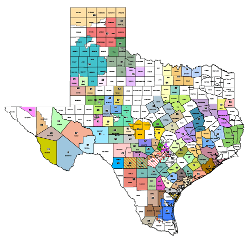
Texas is home to almost 100 GCDs, many of which were created within the past 20 years.[13] Roughly 70 percent of the state is represented by GCDs, including 72 percent of the state’s aquifers.[14] Overall, GCDs play a large role in maintaining safe and adequate supplies of groundwater for Texans to use for years to come (Exhibit 3).
Exhibit 3 Groundwater Conservation Districts in Texas
Submitting a management plan to the Texas Water Development Board (TWDB) that details the current issues as well as substantive goals and plans of action to address those issues.[16]
The Edwards Aquifer Authority (EAA) is a regional GCD created in 1993 as a direct result of the Edwards Aquifer Authority Act, which was passed by the Texas Legislature to prevent federal intervention and allow local and state governance to dictate conservation and preservation of the Edwards Aquifer.[17] The EAA estimates that 2.6 million acre-feet of water that could have been pumped from the Edwards from 1997 to 2014 was preserved as a result of its regulatory measures. Instead of this water being pumped from the aquifer, it stayed within the aquifer and provided a crucial water source to users and endangered species within the central Texas region.[18]
The majority of EAA’s comprehensive funding comes from aquifer management fees that groundwater withdrawal permit holders must pay. In 2022, aquifer management fees generated roughly $31 million of the $35.7 million budget. In 2022, 30 percent of this budget is set to be reinvested into the greater San Antonio region through water quality control, aquifer protection and research, abandoned well awareness, education programs and more.[19] In 2007, Comptroller Glenn Hegar, then serving as a state senator, spearheaded the creation of the Edwards Aquifer Recovery Implementation Program, which led to the development and successful implementation of the Edwards Aquifer Habitat Conservation Plan that seeks to protect threatened and endangered species within the aquifer and their habitat.[20]
The state’s largest GCD is the High Plains Underground Water Conservation District (HPUWCD), which is in the Panhandle and serves 11,850 miles of land across 16 counties. The HPUWCD is Texas’ first GCD, founded in 1951 by residents of the area in collaboration with the Texas Legislature.[21] Roughly 2.5 million acres of farmland in HPUWCD use groundwater for irrigation purposes, which has led to economic stability in the heavily agricultural-based area.[22]
Groundwater Management Areas
Groundwater management areas (GMAs) are geographical regions designated to “provide for the conservation, preservation, protection, recharging and prevention of waste of the groundwater and of groundwater reservoirs.”[23] There are two categories of GMAs established by the Texas Commission on Environmental Quality and the TWDB: regular and priority.
Regular GMAs coordinate groundwater management for groundwater sources throughout the state, whether those sources are scarce or not. Conversely, the Texas Commission on Environmental Quality designates Priority Groundwater Management Areas (PGMAs) as geographic areas “experiencing, or expecting to experience, within 50 years, critical groundwater problems including shortages of surface water or groundwater, land subsidence resulting from groundwater withdrawal, or contamination of groundwater supplies.”[24] The process to designate an area as a regular or priority GMA is lengthy and requires the analysis of an array of testimony and evidence. If an area is designated as a PGMA, a new GCD can be created to help manage it.[25]
As of July 2021, there are eight PGMAs in Texas (Exhibit 4).[26]
Exhibit 4 Priority Groundwater Management Areas in Texas
Priority Grounwater Management Areas are:
Brisco, Swisher and Hale County PGMA
Central Texas - Trinity aquifer PGMA
Regan, UPton and Midland County PGMA
Hill Country PGMA (includes Northern Bexar County Study Area )
North - Central Texas Trinity and Woodbine PGMA
Source: Texas Commission on Environmental Quality
Future of Groundwater
With droughts and varying weather conditions changing the landscape of Texas, groundwater management is more urgent than ever. Many areas of Texas are experiencing record-low water levels in aquifers, lakes and rivers. In 2022, the Nueces and Frio rivers experienced zero water flow in certain parts.[27] Along the southern border of Texas at Falcon Lake, levels are so low that water is no longer able to properly flow through the dam located there.[28]
Texas GCDs continue to address these concerns and have initiated long-term goals and innovative practices to address low water levels; some water experts, however, argue that these goals will not properly address water conservation.[29] Certain organizations, such as the Meadows Center for Water and the Environment, have provided research demonstrating the current rate of groundwater pumping for certain aquifers is unsustainable in the long term. The Ogallala aquifer, the largest aquifer in the state and country, is expected to experience a 50 percent decline in groundwater levels from 2020 to 2070. Additionally, the Carrizo-Wilcox, Gulf Coast, Seymour and Trinity aquifers all are expected to experience a decrease in groundwater levels during the same period.[30]
With plans that include desalination efforts, aquifer storage and recovery, and other methods to preserve groundwater levels, groundwater will continue to be a top priority in Texas.[31]
Endnotes
Links are correct at the time of publication. The Comptroller's office is not responsible for external websites.